
A Real Stretch
Okeene and Karns, OK
23 May 11

SHORT: Observed small tornado W of Okeene OK and nontornadic supercell E of Greenfield OK.
LONG:
This “day before the day” heralded the beginning of the long-advertised “undercutting Pacific jet”, and impingement of a strong, broadly cyclonically curved upper wind max over the southwestern CONUS as a 500-mb cyclone closed over the Pacific NW. I much prefer patterns like this for observable supercells than closed, stationary to retreating northern-Plains lows like we had just seen.
A strongly difluent upper height pattern spread over the southern High Plains late in the afternoon with subtle height falls occurring across much of the region. The presence of a dryline that was
1. Beneath those height falls and
2. Bounding the west rim of a rich moist sector (at least over the TX portion)
…was a high-confidence scenario, the specifics being maxima in low-level lift versus strength of capping into evening.
Accordingly, Jack Beven and I, in caravan with DF’s “Dude, Three Chicks and a Dog” chase team, headed W on I-40 to await storm initiation along the dryline in a strongly heated and increasingly moist air mass.
Along with Howie Bluestein, Dan Dawson, Jeff Snyder and other scientists and students accompanying OU mobile radars, we waited and shopped at the Cherokee tribal store on I-40 near Calumet, until echoes appeared to our SW, W and NW. We parted with the OU crews, briefly stopped to watch some high-based junk SW of Watonga, then targeted the much more healthy Fairview/Okeene storm.
In fact, the storms SW of Watonga were everything but photogenic; and we still were in transit northward Okeene when we caught a view of a suspicious lowering under the emerging base W of Okeene. In a rare event for me, my first photos on this day therefore were of a tornado!
By 1618 CDT, when we pulled over along a section road 3 S Okeene, the lowering had become a well-defined funnel cloud about 5 NW of us or ~4 W Okeene. It was tilted nearly horizontally (wide-angle with foreground storm structure), and already tornadic based in dust-whirl reports by closer observers. Time was 1618 CDT. The newer updraft base almost overhead seemed to be the next candidate for a mesocyclone formation/occlusion process; but it actually moved N and got absorbed into the forward flank, vanishing in the process.
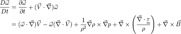
Meanwhile, we witnessed, photographed and reported the 6-minute tornado from the same vantage as a debris cloud became more and more apparent (unenhanced and super-enhanced photo). Shortly before the tornado dissipated, the debris cloud got displaced astonishingly far S of where the condensation funnel met the cloud base. Clearly the stretching term of the vorticity equation was at play here.
We stayed with the storm for about 45 more minutes just E of Okeene as another small thunderstorm formed to its S, moved over us with frog-strangling rain and closely slamming CGs, then merged into the main updraft region. This pathetic state of affairs left the supercell demolished as a discrete entity. What was left merged into a massive multicellular morass extending some 70 miles E-W across the area. Now what?
Onboard radar feeds tempted us intensely with displays of a solitary supercell about 75 miles to our S near Gotebo, and there was plenty of daylight to head down there and spend some quality time with that storm before dark. Off we went, photographing a smaller cell to our SSW over Watonga. (which would become the supercell E of Greenfield) and later a distant presentation of the convective mass we had left.
That Watonga storm looked rather innocuous as we passed under its early updraft base in and S of town. However, by the time we reached Greenfield and around to the S side, the convection grew explosively into a full-blown young supercell with bright, hard-looking updraft towers boiling up the back side. The upward eruption of the convection easily was visible in real-time via our eyeballs, as was the onset of helical turning in the midlevels, white turrets and cauliflower tops rocketing skyward and veering rightward like daddy likes to see.
We didn’t intercept this storm; it intercepted us. The supercell blossomed right besides us on the way S, in an environment not seeming too different from more mature supercell to which we had been aimed; so we diverted from plan, maneuvering the backroads NE of Karns into the near-inflow region of the Greenfield storm instead. Its first mesocyclonic occlusion attempt happened just to our NNW with a well-defined, if elongated, wall cloud that rotated only slowly. Rotation tightened considerably after the mesocyclone became deeply occluded, slotted and nearly cut-off from the rest of the storm, having been kicked way back out the NW side of the storm. Alas, loss of buoyancy overcame stretching; and the circulation perished.
After that, several areas of weak-moderate rotation materialized along an increasingly elongated cyclonic-shear and convergence zone; but the supercell itself was getting weaker and more strung out. We left it and headed S on US-81 through El Reno, once again headed for the initially intended supercell still a little over an hour S of us; but that storm died before we got past Tuttle. Little did Jack and I realize we were crossing the path that a certifiably violent and deadly wedge tornado would take the following day.
We enjoyed seeing Jim Leonard in the field as well as the aforementioned OU folks, and had a fine dinner in Norman with Matt Crowther, Betsy Abrams, Greg Stumpf, and my beautiful bride Elke, who couldn’t chase on this day. It was a fine and fitting end of the “day before the day” setup. What a wild, frightening, intense, and historic day the “day after the day before the day” would turn out to be…